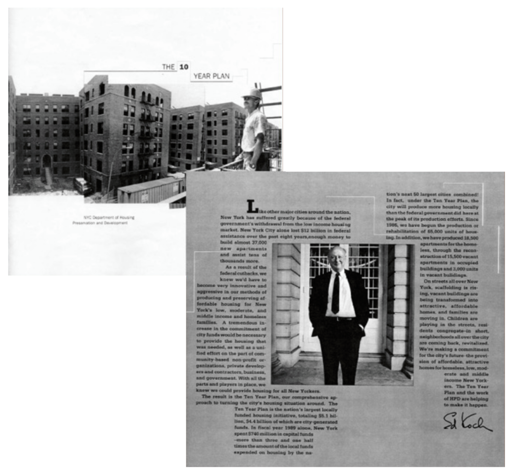
In the 1980s the Federal Government drastically cut spending on programs for low and moderate income housing. At the same time the City of New York inherited approximately 60% of the property in Harlem because of landlord abandonment and tax delinquency. Disinvestment in Harlem and other neighborhoods left the housing stock deteriorated and many areas were wastelands of empty lots and vacant buildings. Faced with solving this problem without federal funds, the city needed a plan.
The administration of Mayor Ed Koch evolved an innovative and aggressive approach to restoring and developing affordable housing for low, moderate and middle-income families. The plan was a $5.1 billion dollar commitment of city funds called the Ten Year Plan. In 1986 New York City’s Department of Housing Preservation and Development assumed the task of administering the plan. HPD set out to improve the availability, affordability and quality of housing by using a variety of preservation and enforcement strategies. As the nation’s largest municipal housing agency, HPD worked with private, public and community-based organizations to strengthen neighborhoods, restore buildings and create affordable homeownership.
Ibo Balton, Director of Project Planning for Manhattan, and his staff utilized a number of strategies to address the blighted conditions. The Sanborn map below was an early planning tool used to identify HPD ownership and investments. It now serves as a snapshot in time of the extent of disinvestment and redevelopment by the mid 90s. The various colors on the map tell the condition and ownership of the property. Red signifies that the property is either completed or still under construction. Rust brown represents privately owned vacant buildings in disrepair. Chocolate brown signifies city-owned vacant buildings, while Yellow represents city-owned occupied buildings and black signifies city-owned vacant land. Gray represents private vacant land, and no color means the property required no immediate intervention. Today, due in large part to the shared vision and efforts of HPD and community based organizations, vacant and boarded-up buildings that were once eyesores have been transformed into affordable homes for stable and healthy communities.
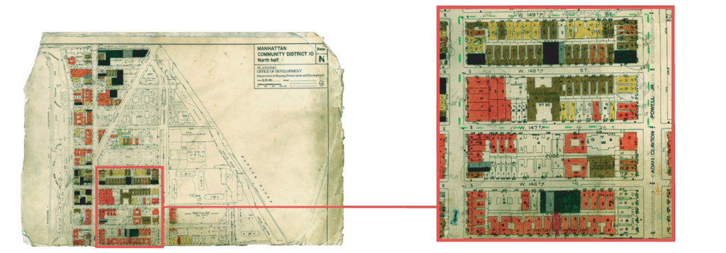
The blocks between Frederick Douglass and Adam Clayton Powell, Jr. Boulevards, shown hear left, illustrate the magnitude of deterioration and rehab involved in building-out the Bradhurst Urban Renewal Plan. Red properties along the 145th Street and Frederick Douglass Boulevard were completed under Bradhurst Phase 1 (1994-7). Most of the “brown” and “black” properties on 148th Street were completed by HPD in partnership with HCCI and private developers by 2003.
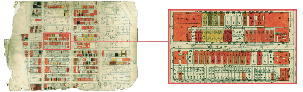
The detail at left of West 140th Street between Frederick Douglass and Adam Clayton Powell, Jr. Boulevards depicts the extent to which properties that had fallen into city ownership were being renovated by HPD and community developer Harlem Congregations for Community Improvement (HCCI).
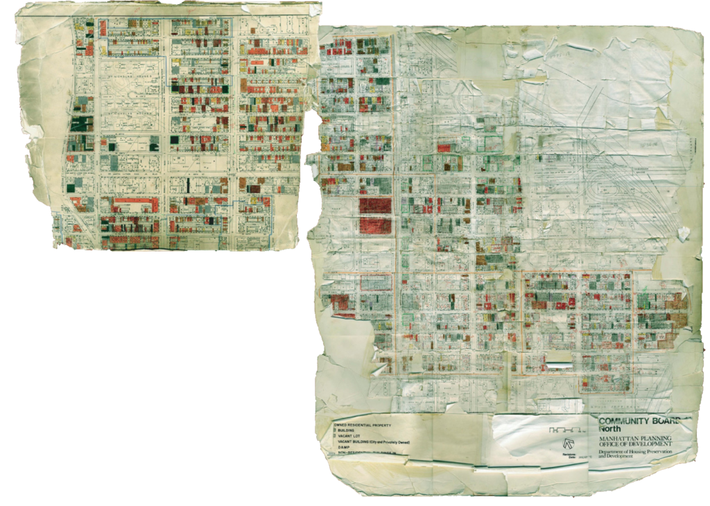
Above is a composite photo of hand-colored Sanborn Maps used by the HPD to track abandonment and rehab projects in Harlem starting in 1995. The fifth section covering Morningside Heights and southern Central Harlem was lost.

This entry is licensed under a Creative Commons Attribution-NonCommercial-ShareAlike 4.0 International license.